Boulder Mountain climbs out of the timber above St. Elmo and works its way up a series of switchbacks toward an old mine site above 12,700 feet. The road is part of the larger Mount Antero trail system in the Sawatch Range, inside the San Isabel National Forest west of Nathrop. Expect a narrow shelf road, a wide avalanche chute crossing, and open views once the trail breaks above treeline. This is an out and back trail, so the same road serves as both the way up and the way down.
Trail Summary
- Location: Sawatch Range, San Isabel National Forest, near St. Elmo, Chaffee County, Colorado
- Distance: 6.0 miles one way (12.0 miles round trip)
- Difficulty: Level 4, typically challenges the limits of a high clearance 4x4
- Minimum Elevation: 9,383 ft
- Maximum Elevation: 12,757 ft
- Elevation Gain: 3,300 ft
- Travel Time: about 1 hour 45 minutes one way (recorded), 3 to 3.5 hours round trip
Difficulty
Typically challenges the limits of a high clearance 4x4
Low range gearing is needed and undercarriage damage is a real possibility on this trail. The road surface alternates between rock and undulating dirt, with obstacles under 18 inches such as ledges, short climbs, and loose sections that call for careful tire placement. Grades can be steep, loose, and slightly off camber.
The roadbed stays uneven and rutted for most of the climb, with loose rock, sand, and erosion in spots. The trail runs about one vehicle wide with limited places to pass, so plan for oncoming traffic on busy weekends.
Elevation
The route starts at about 9,383 feet in the trees along Baldwin Creek and climbs steadily to just over 12,750 feet near an old mine site below the Boulder Mountain summit. Nearly all of the 3,300 feet of gain comes on the way up, with only minor dips along the roadbed. There is essentially no elevation to give back until the return trip down the same road.
Terrain
This is high alpine terrain for most of the upper half of the drive. The lower stretch runs through conifer forest and aspen groves before the road breaks above treeline and crosses a wide avalanche chute. From there the trail follows a narrow shelf cut into talus slopes, with a couple of tippy spots where the road edge falls away sharply. There are no named obstacles, but the combination of altitude, narrow tread, and loose rock keeps the drive technical.
4WD Experience
Low range and careful tire placement matter more than raw power on this trail. The road is one vehicle wide for long stretches with only occasional pullouts, so a spotter helps on the tighter switchbacks. High clearance and skid plates are worth having given the rock and rutted sections, and oversized rigs will struggle on the narrow shelf sections above treeline.
Travel Time
The recorded run up the mountain took about 1 hour and 45 minutes, with roughly 1 hour and 27 minutes of that in motion and the rest spent stopped along the way. This is an out and back trail, so the return trip down the same road takes about the same amount of time as the climb. Plan on 3 to 3.5 hours total for the round trip, with extra time built in for photo stops or a break at the top.
Highlights
The switchbacks above the avalanche chute open up views of Cronin Peak and the Baldwin Valley below. Above treeline the trail crosses talus slopes with a clear line of sight down the valley and across to the surrounding peaks of the Mount Antero trail system. The road ends near an old mine site, a good turnaround point and lunch stop before heading back down.
Trail GPS File
Map
GAIA GPS Track
Photos
Photo 1 (38.7056, -106.2807, estimated from timestamp)

Photo 2 (38.7037, -106.2749, estimated from timestamp)

Photo 3 (38.6995, -106.2793, estimated from timestamp)

Photo 4 (38.6994, -106.2792, estimated from timestamp)

Photo 5 (38.6829, -106.2836, estimated from timestamp)

Photo 6 (38.6868, -106.2893, estimated from timestamp)
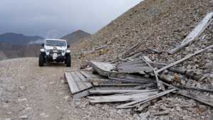
Photo 7 (38.6868, -106.2893, estimated from timestamp)

Photo 8 (38.6868, -106.2893, estimated from timestamp)
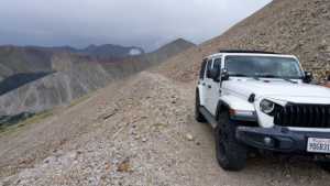
Photo 9 (38.6873, -106.2897, estimated from timestamp)

Photo 10 (38.6873, -106.2896, last recorded track point)
