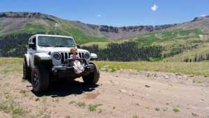
Rat Creek is a high alpine side loop off the historic Bachelor Loop above Creede, Colorado. The route climbs out of spruce timber into open tundra near the Continental Divide before dropping back down through old mining ground toward Willow Creek. It sits in a gray area between an easy shelf road and a trail that demands real 4WD capability, which is why local guides tag it as a 2.5. Expect loose rock, a few rutted climbs, and some of the best high country views in the San Juans.
Trail Summary
- Location: Near Creede, Colorado, off CO Highway 149 and Bachelor Loop Road (FS Road 504)
- Distance: 13.5 miles
- Difficulty: Level 2.5 - Typically suitable for high clearance 2WD, best suited for a high clearance 4x4 on the upper switchbacks
- Minimum Elevation: 10,266 ft
- Maximum Elevation: 12,533 ft
- Elevation Gain: 3,117 ft
- Travel Time: 2 hours 6 minutes recorded
Difficulty
Typically suitable for high clearance 2WD, best suited for a high clearance 4x4 on the upper section
Stock equipment is sufficient for most of the lower trail, but the terrain above treeline will test tire traction and ground clearance. Expect dirt and rocky road with obstacles generally under 9 inches, including rocks, dips, and ruts. Grades are steep in the switchback sections but traction is generally good in dry conditions. The road is typically one to two vehicles wide, with unmaintained sections after rain or snow and the possibility of shallow water crossings near the creek bottoms.
Elevation
The trail starts near 10,266 feet along Willow Creek and climbs steadily to a high point of 12,533 feet on the tundra near the Continental Divide. Total elevation gain over the route comes to roughly 3,117 feet, with about 2,831 feet of loss on the return descent. The climb is gradual through the lower timber before steepening noticeably in the switchback section above 11,500 feet.
Terrain
This is high alpine terrain. The route works through frequent switchbacks as it gains significant elevation, moving from forested valley bottom into exposed tundra above 11,500 feet. Surface conditions shift from packed dirt and small rock in the trees to looser, rockier tread near the ridge, where wind and snowmelt keep things eroded. Watch for narrow sections with limited passing room on the climb.
4WD Experience
A high-clearance 4WD vehicle handles this trail without much drama in dry conditions. The lower stretch along Willow Creek is a mellow two-track through timber. Things pick up on the switchbacks climbing toward the divide, where loose rock and tighter turns call for careful line choice and low range in a few spots. Full-time 4WD or a locking rear diff is a plus but not required for a stock rig with good tires. After rain or snowmelt, the upper tundra section gets soft and rutted, so plan around wet weather when possible.
Travel Time
The recorded track shows a total travel time of 2 hours 6 minutes for the 13.5 mile route. For a high-clearance 4WD vehicle driving at a steady but unhurried pace, budget 2 to 2.5 hours for the drive itself, and closer to 3 hours with stops for photos at the overlooks near the divide. Add extra time if the trail is wet or if there is snow lingering above 11,500 feet, which is common into early summer.
Highlights
The high point near the Continental Divide offers sweeping views across the San Juan Mountains, with a short spur worth walking for an even better vantage. The lower trail passes through lush meadows and dense timber along Willow Creek before opening onto alpine tundra. Remnants of the area's silver mining history, including old workings near the Equity Mine along the connecting Bachelor Loop, add some historic interest to the drive. Wildlife sightings, including elk and the occasional moose, are common along the creek bottoms.
Trail GPS File
Map
GAIA GPS Track
Photos
Photo 1 (GPS Location: 37.946902, -106.989817, estimated from timestamp)
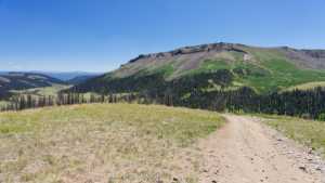
Photo 2 (GPS Location: 37.946906, -106.989820, estimated from timestamp)
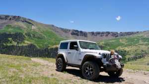
Photo 3 (GPS Location: 37.946910, -106.989824, estimated from timestamp)