Bald Mountain Trail runs through the Diamond Fork area of the Uinta-Wasatch-Cache National Forest, climbing a wide shelf road up onto the ridge above Rays Valley Road. It is a mellow, well graded route with plenty of camping along the way, making it a good pick for a relaxed afternoon drive or an easy overnighter close to Spanish Fork.
Trail Summary
- Location: Diamond Fork area, Uinta-Wasatch-Cache National Forest, near Spanish Fork, Utah
- Distance: 3.4 miles
- Difficulty: Level 1, suitable for high clearance 2WD
- Minimum Elevation: 8,488 ft
- Maximum Elevation: 9,048 ft
- Elevation Gain: 458 ft
- Travel Time: 30 to 45 minutes
Difficulty
Suitable for high clearance 2WD
Stock equipment is sufficient and no special gear is needed on this route. Expect a dirt and rocky road with a few water bars and dips less than 5 inches, along with slight grades and good traction throughout. The road stays wide enough for two vehicles for most of its length, making it safe for most 4WD rigs and high clearance 2WD vehicles alike.
Elevation
The trail climbs from about 8,488 feet near the trailhead to a high point of 9,048 feet, a total gain of roughly 458 feet spread out over gentle, rolling terrain. Total elevation loss on the return grades comes in close behind at 459 feet, and the route ends only about 19 feet higher than where it started, so the overall profile is a steady up and down rather than one long climb.
Terrain
This is mountain shelf road and rocky two-track for its entire length. The first stretch out of the trailhead is a proper shelf road cut into the hillside, wide enough for one vehicle, with a series of water control dips and humps that are worth a look before bringing anything long or low behind you. Past that, the road mellows into rolling forest two-track that winds along the ridge with a mix of dirt and scattered rock.
4WD Experience
A stock high clearance 2WD or any 4WD rig will handle this trail without issue. The water bars near the start are the only spots that call for a bit of care, especially towing a trailer, but there is nothing here that challenges ground clearance or traction in dry conditions. The road holds one to two vehicles wide most of the way, with regular pull outs at the camp spots along the route. The one obstacle called out along the trail is rated a level one, about as mild as it gets.
Travel Time
The recorded track time for this route came in at about 13 minutes, which reflects a straight drive through without stopping. Budget closer to 30 to 45 minutes for an actual run, since there is plenty to see along the way and several camp spots worth a slow look if you are scouting for a place to stay.
Highlights
The shelf road at the start offers a good early view back down the canyon, and the string of camp spots along the ridge, from the open five to eight rig site to the more private mountain camp further along, make this trail worth running just to scout overnight options. The forested stretches near the far end offer shade and a change of scenery from the open shelf road below.
Map
Interesting Waypoints
Waypoint 1 (40.037548, -111.200738)

Waypoint 2 (40.037548, -111.200738)
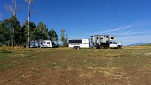
Waypoint 3 (40.037548, -111.200738)

Waypoint 4 (40.037548, -111.200738)

Waypoint 5 (40.026340, -111.190768)

Waypoint 6 (40.026340, -111.190768)
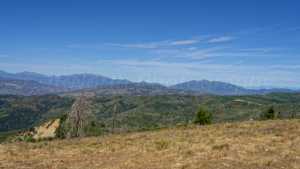
Waypoint 7 (40.026340, -111.190768)

Waypoint 8 (40.026340, -111.190768)

Waypoint 9 (40.025092, -111.186628)
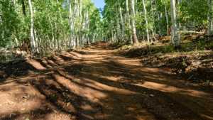
Waypoint 10 (40.020413, -111.169800)

Waypoint 11 (40.020413, -111.169800)

Waypoint 12 (40.020413, -111.169800)
