Bowery Creek Yankee follows a forest road out of the Cedar Mountain high country to Yankee Meadows Reservoir, climbing through gamble oak and mahogany hillsides before easing into open meadow near the water. The road starts out narrow and a bit rough, then widens and smooths out considerably once it joins Yankee Meadows Reservoir Road for the final stretch to the lake.
Trail Summary
- Location: Parowan, Utah
- Distance: 2.7 miles
- Difficulty: Level 2
- Elevation: From 8,552 feet to 8,983 feet with a 430 foot change
- Travel Time: 33 minutes
Difficulty
Typically suitable for high clearance 2WD
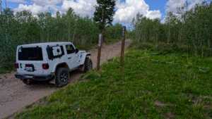
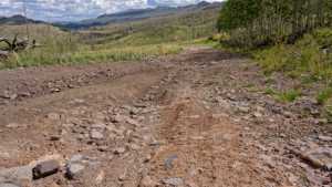
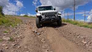
Stock equipment is enough to handle this route, though a couple of spots along the way will test tire traction and ground clearance. The road is dirt and rocky, with obstacles under 9 inches such as rocks, dips, and ruts, and a couple of short, steep sections that hold decent traction. Two stretches early on stand out as harder going, one near the start and another about a mile in, so drivers should be ready for some careful tire placement in those areas. Once the road joins Yankee Meadows Reservoir Road, the surface eases up and stays mellow the rest of the way to the lake.
Terrain
The road climbs through Dixie National Forest on Cedar Mountain, winding through gamble oak and mahogany-covered hillsides typical of this part of southern Utah. As the route gains elevation it moves into aspen and spruce, with the road narrowing to about one vehicle wide through the rockier sections before opening back up. Near the reservoir the terrain flattens into meadow, with the surface changing to a well-graded gravel road for the final approach to the water.
Highlights
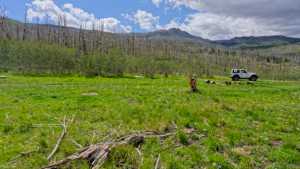
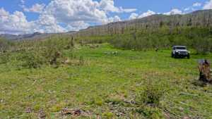
A camping spot along the way holds two or three smaller rigs, with a bit of privacy though no shade. The trail ends at Yankee Meadows Reservoir, a small reservoir built for irrigation with volcanic cliffs rising in the distance and good trout fishing for brook and rainbow trout. The reservoir shoreline is open to the public even though it sits on private water rights, and it makes a popular stop for anglers and paddlers heading up from Parowan.
Map
Waypoints
 |
Waypoint 1 (37.73403, -112.78553) |
 |
Waypoint 2 (37.73403, -112.78553) |
 |
Waypoint 3 (37.73403, -112.78553) |
 |
Waypoint 4 (37.73403, -112.78553) |
 |
Waypoint 5 (37.73652, -112.78247) |
 |
Waypoint 6 (37.73652, -112.78247) |
 |
Waypoint 7 (37.73741, -112.78681)This spot works as a campsite for two or three smaller rigs. It is not shaded but offers a bit of privacy. Room for a larger trailer has not been confirmed. |
 |
Waypoint 8 (37.73741, -112.78681)This spot works as a campsite for two or three smaller rigs. It is not shaded but offers a bit of privacy. Room for a larger trailer has not been confirmed. |
 |
Waypoint 9 (37.73741, -112.78681)This spot works as a campsite for two or three smaller rigs. It is not shaded but offers a bit of privacy. Room for a larger trailer has not been confirmed. |
 |
Waypoint 10 (37.73741, -112.78681)This spot works as a campsite for two or three smaller rigs. It is not shaded but offers a bit of privacy. Room for a larger trailer has not been confirmed. |
 |
Waypoint 11 (37.73741, -112.78681)This spot works as a campsite for two or three smaller rigs. It is not shaded but offers a bit of privacy. Room for a larger trailer has not been confirmed. |
 |
Waypoint 12 (37.73830, -112.78625)This section is another harder stretch of the road, roughly level 2. |
 |
Waypoint 13 (37.73830, -112.78625)This section is another harder stretch of the road, roughly level 2. |
 |
Waypoint 14 (37.75453, -112.77256)The road ends at Yankee Meadows Reservoir. |
 |
Waypoint 15 (37.75453, -112.77256)The road ends at Yankee Meadows Reservoir. |