Brindley Dairy climbs across the top of the Sevier Plateau in the Fishlake National Forest, following a route once used to move dairy cattle up from the valley floor for summer grazing. The trail runs through rocky washes, open meadows, and stands of aspen and pine before opening onto sweeping views of the valley below.
Access is from Box Creek Canyon Road out of Greenwich, Utah, which climbs into the forest and ties into this stretch of the Paiute Trail system on the Sevier Plateau.
Trail Summary
- Location: Near Greenwich, Utah (Highway 62 at Box Creek Canyon Road), Fishlake National Forest
- Distance: 3.1 miles
- Difficulty: Level 2
- Elevation: From 9,278 feet to 9,883 feet, a change of about 605 feet
- Travel Time: 31 minutes
Difficulty
Typically suitable for high clearance 2WD
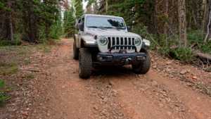
Stock equipment is enough for this trail, though the terrain will test tire traction and ground clearance in places. The opening stretch is rocky, and the rest of the route settles into a mix of dirt and rock with gentle to moderate grades. The road narrows to about one vehicle wide in spots with room to pass, and the main things to watch for are loose rock and rutted sections rather than any major ledges or drops.
Terrain
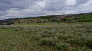
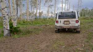
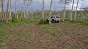
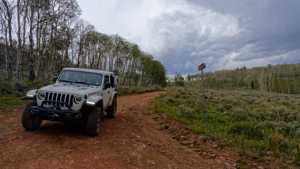
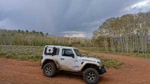
The trail starts on a rocky surface before easing into a long stretch of gravel and rock road. Partway along, it opens into a meadow with patches of green grass giving way to sagebrush. Further south, the route runs through forested camping pockets shaded by aspens and pines, some of it regrown after a wildfire that passed through within the last couple of decades, leaving downed timber alongside well-established new growth. Near the end, the trees thin out and the trail climbs onto an overlook with a wide view across the valley.
Highlights
Brindley Dairy takes its name from a family dairy operation that ran here from 1891 to 1894, when the Brindleys moved their cows up from the Greenwich area to graze through the summer months. Several camping spots line the route, ranging from a small pocket that fits one or two rigs to a larger clearing with room for four or five rigs and trailers, most offering at least some shade. The final stretch opens to a broad valley overlook ringed with aspens, a good place to take in the Sevier Plateau before heading back down.
Map
Waypoints
 |
Waypoint 1 (38.5272, -112.0178)This is the start of the Brindley Dairy trail, Forest Service trail number 40160. |
 |
Waypoint 2 (38.5272, -112.0178) |
 |
Waypoint 3 (38.5272, -112.0178) |
 |
Waypoint 4 (38.5272, -112.0178) |
 |
Waypoint 5 (38.5267, -112.0170) |
 |
Waypoint 6 (38.5267, -112.0170) |
 |
Waypoint 7 (38.5166, -112.0223) |
 |
Waypoint 8 (38.5166, -112.0223) |
 |
Waypoint 9 (38.5166, -112.0223) |
 |
Waypoint 10 (38.5043, -112.0114) |
 |
Waypoint 11 (38.5043, -112.0114) |
 |
Waypoint 12 (38.5043, -112.0114) |
 |
Waypoint 13 (38.5029, -112.0087)This camping spot has trees and a little shade, no privacy, and is large enough for four or five rigs with trailers. |
 |
Waypoint 14 (38.4999, -112.0105)The view opens up here over a valley with plenty of open space. There are campsites nearby surrounded by aspens. |
 |
Waypoint 15 (38.4997, -112.0106) |
 |
Waypoint 16 (38.4997, -112.0106) |
 |
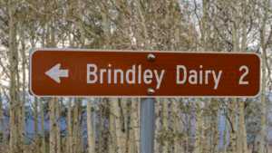
Waypoint 17 (38.4993, -112.0110)This marks the end of the Brindley Dairy trail. |
 |
Waypoint 18 (38.4993, -112.0110) |