Buffalo Canyon climbs out of the Snake Creek drainage on the east side of the Wasatch Range, working through sagebrush hillsides and a handful of easy sidehill sections above the creek below. It is a mellow route, well suited to a first trip out with a stock rig or a relaxed cruise for anyone looking to add mileage to a bigger day in the area.
Trail Summary
- Location: Uinta-Wasatch-Cache National Forest, near Midway, Utah, off Snake Creek Road
- Distance: 2.8 miles one-way
- Difficulty: Level 1
- Minimum Elevation: 8,436 ft
- Maximum Elevation: 8,926 ft
- Elevation Gain: 470 ft
- Travel Time: About 22 minutes recorded
Difficulty
Suitable for high clearance 2WD
Stock equipment is sufficient here and no special gear is needed. The road surface is dirt and rock with a scattering of small dips and ruts, none more than about 5 inches deep. Grades stay gentle and traction is good throughout. The road runs wide enough for two vehicles to pass through most of its length, making this a safe outing for most 4WD rigs and high-clearance 2WD vehicles alike.
Elevation
The track starts at 8,436 feet and climbs to a high point of 8,926 feet by the end of the recorded route, a net gain of about 384 feet. Total recorded gain came in at 470 feet against 86 feet of loss, so the road trends steadily uphill with only a few short downhill dips along the way. Nothing about the climb is abrupt. It is a steady grind rather than a series of steep pitches.
Terrain
Expect mountain shelf road and rocky two-track for the length of the drive. The route sidehills across open, sage-covered slopes above the creek drainage, with a narrow shelf in a few spots where the road cuts across the hillside. Surface is a mix of packed dirt and loose rock, easy to read and easy to place tires on.
4WD Experience
A high-clearance 4WD vehicle will have no trouble here. Stock ground clearance and street tires are enough for the whole route, though the narrow shelf sections deserve a bit of attention, particularly if passing another vehicle. Realistic travel time for a 4WD rig taking it easy and stopping for photos runs about 30 to 40 minutes one-way, longer if you linger at the overlooks or the camping area near the start.
Travel Time
The recorded track logged 22 minutes and 28 seconds total, with about 13 minutes of that in motion and the rest spent stopped, mostly at the trailhead camping area and a couple of the viewpoints along the shelf. Budget more time than the raw moving time suggests if you plan to stop and take in the scenery.
Highlights
The drive opens at a hilltop camping area with room for several rigs and a view out over the power line corridor, a good spot to stage before heading up canyon. From there the road settles into a long sidehill traverse with open views across the drainage, working past a series of small pullouts and overlooks before dropping toward the canyon bottom near the far end of the route. Wide open sky and sagebrush color the whole drive, with the creek below tracking along for much of the way.
Map
Interesting Waypoints
Waypoint 1 (40.044178, -111.156482)
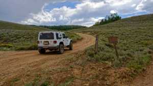
Waypoint 2 (40.044178, -111.156482)

Waypoint 3 (40.044178, -111.156482)

Waypoint 4 (40.044178, -111.156482)

Waypoint 5 (40.042540, -111.177283)
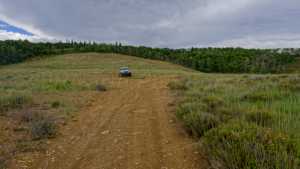
Waypoint 6 (40.042540, -111.177283)
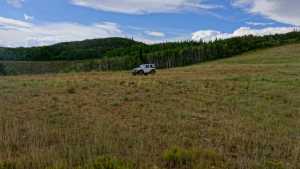
Waypoint 7 (40.042540, -111.177283)

Waypoint 8 (40.042027, -111.177398)

Waypoint 9 (40.042027, -111.177398)

Waypoint 10 (40.042027, -111.177398)

Waypoint 11 (40.038130, -111.191470)
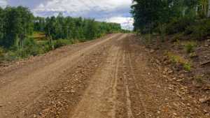
Waypoint 12 (40.036740, -111.198738)

Waypoint 13 (40.036740, -111.198738)
