Cedar Hollow OHV Trail (FS 80203) is a short shelf road climbing through pine and aspen forest in the Uinta-Wasatch-Cache National Forest. The route is narrow from the first turn and stays that way, with brush close enough on both sides to pinstripe wider vehicles. A rocky, uneven stretch partway up is the main technical challenge, and the trail ends at a tight turnaround loop set among tall grass and timber.
Trail Summary
- Location: Uinta-Wasatch-Cache National Forest, near Kamas, Utah, off State Route 150 (Mirror Lake Highway)
- Distance: 1.0 mile one way to the turnaround
- Difficulty: Level 2, typically suitable for high clearance 2WD
- Minimum Elevation: 8,213 ft
- Maximum Elevation: 8,375 ft
- Elevation Gain: 155 ft
- Travel Time: 20 to 30 minutes one way
Difficulty
Typically suitable for high clearance 2WD
Stock equipment is sufficient, but the terrain will test tire traction and ground clearance in a few spots. The surface is dirt and rock with occasional dips and ruts under 9 inches, and grades can feel steep even though traction stays good most of the way. After rain or snow the road goes unmaintained, so expect shallow washouts and small ledges up to about 12 inches. The road runs one to two vehicles wide for most of its length, narrowing further where brush closes in.
Elevation
The trail climbs from 8,213 feet to a high point of 8,375 feet, a gain of 155 feet and a loss of 124 feet over the course of the drive, for a net change of about 32 feet. The elevation profile is modest and gradual rather than a steady climb, with a couple of short rises and dips built into the shelf road rather than one long grade.
Terrain
This is mountain shelf road and rocky two-track for its entire length. The route hugs the hillside through stands of pine and aspen, opening at a few points to views across the valley and surrounding ridgelines. Roughly a third of the way in, the surface turns to embedded and loose rock with uneven footing. Past that, the road narrows further and pushes through tall grass and brush before ending at a small, tight turnaround.
4WD Experience
A stock high clearance 2WD can handle most of this trail, but the rocky midsection rewards careful tire placement and a 4x4 with some articulation will have an easier time of it. The narrow sections toward the end are tight enough that wider vehicles will pick up pinstripes from the brush, and there is no way around it. The turnaround at the end is small, tight, and off-camber, so plan the approach before committing to it, especially in a longer wheelbase vehicle. No trailers.
Travel Time
Recorded travel time on this run was about 21 minutes covering the mile to the turnaround, with roughly 17 minutes of that spent actually moving. A high clearance 4WD should plan for 20 to 30 minutes one way, accounting for the slow pace through the rocky section and the narrow, brush-lined stretch near the end. This is a short trail and pairs well with the other Cedar Hollow segments and the broader Mill Hollow and Soapstone Basin trail network nearby.
Highlights
Several openings along the shelf road give clear views down into the valley and across to the surrounding mountains. The forest mix of pine and aspen stays consistent the whole way, and the narrow, grass-lined approach to the turnaround has its own quiet character. The tight, off-camber turnaround at the end is a small technical highlight in its own right.
Map
Photos
Photo 1 (GPS Location estimated from timestamp)
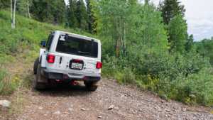
Photo 2 (GPS Location estimated from timestamp)

Photo 3 (GPS Location estimated from timestamp)
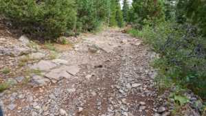
Photo 4 (GPS Location estimated from timestamp)

Photo 5 (GPS Location estimated from timestamp)
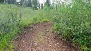
Photo 6 (GPS Location estimated from timestamp)

Photo 7

Photo 8

Photo 9
