Dry Hollow Road is a short connector route in the Soapstone Basin area of the Uinta-Wasatch-Cache National Forest, just off Wolf Creek Pass. Marked with trail post 181, it drops from a burned hillside down through recovering forest to a seasonal pond before tying into an ATV trail network. It is a quick out-and-back, but the middle section throws in a rocky pitch that keeps things interesting for a road this short.
Trail Summary
- Location: Uinta-Wasatch-Cache National Forest, near Woodland, Utah, off State Route 35 (Wolf Creek Pass) in the Soapstone Basin area
- Distance: 0.4 miles (one way)
- Difficulty: Level 2 - Typically suitable for high clearance 2WD
- Minimum Elevation: 8,497 ft
- Maximum Elevation: 8,722 ft
- Elevation Gain: 210 ft
- Travel Time: Approximately 15-20 minutes
Difficulty
Typically suitable for high clearance 2WD
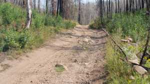
Stock equipment is sufficient, but the terrain will test tire traction and ground clearance in a couple of spots. Expect a dirt and rocky roadbed with obstacles under 9 inches, such as embedded rocks, dips, and ruts. One stretch climbs at a steeper grade with looser footing, but traction stays reasonable throughout.
Elevation
The road climbs steadily from 8,497 feet at the bottom to 8,722 feet near the top, a gain of about 210 feet over less than half a mile. There is no significant descent along the recorded route, so the climb is consistent from start to finish rather than rolling.
Terrain
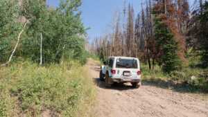
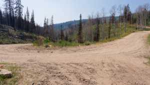
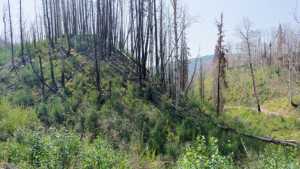
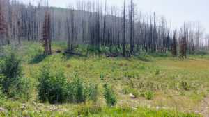
The route runs through a mix of standing burned timber and dense young regrowth, evidence of a past wildfire working its way back to forest. The roadbed itself is packed dirt with scattered loose rock, narrow enough in places to be one vehicle wide. A grassy, seasonal pond sits just off the main line partway up, and the upper end opens into a meadow before meeting an ATV trail.
4WD Experience
This is a mild trail overall, with one section partway up that stands out as the technical crux. The grade steepens and the surface loosens, calling for careful throttle control and tire placement, but it is well within reach of a stock high clearance vehicle. The rest of the road is straightforward two-track driving.
Travel Time
The recorded track covers the 0.4 mile route in about 10 minutes of driving time. Realistically, budget 15 to 20 minutes each way for a high-clearance 4WD vehicle to allow for the steeper middle section and a stop at the pond overlook.
Highlights
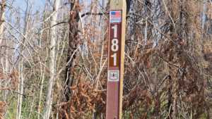
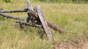
The trailhead is marked with post 181, a good reference point if you are navigating by trail number. Partway up, a short spur leads to a seasonal pond that is not always holding water depending on the time of year. The upper end of the road opens into a meadow with long views back down the drainage before connecting into the ATV trail system, making this a nice short add-on to a longer day of wheeling in the Soapstone Basin area.
Map
Interesting Waypoints
Waypoint 1 (40.51764, -111.037952)
Waypoint 2 (40.517636, -111.037939)

Waypoint 3 (40.517633, -111.037929)
Waypoint 4 (40.51763, -111.037916)
Waypoint 5 (40.516647, -111.035041)
Waypoint 6 (40.51647, -111.034798)
Waypoint 7 (40.516426, -111.034789)

Waypoint 8 (40.515973, -111.034782)

Waypoint 9 (40.515884, -111.034782)
Waypoint 10 (40.514088, -111.032655)
Waypoint 11 (40.514068, -111.032614)
