Dry Lakes Road climbs out of the forest above Parowan Canyon and works its way toward Sugarloaf Mountain and the high country near Brian Head, in the Cedar City Ranger District of Dixie National Forest. This short stretch of Forest Service road is Level 1 and rated for stock, high clearance vehicles, and it runs through mixed conifer along the western flank of the Markagunt Plateau before crossing onto private land, where staying on the established roadbed is the rule.
The route trades quick elevation for big views, dropping steadily off the plateau as Cedar Breaks and Parowan Canyon open up to the west. It makes an easy add-on for a day spent exploring the Brian Head area, whether paired with other Markagunt Plateau roads or driven on its own.
Trail Summary
- Location: Brian Head, Utah
- Distance: 6.0 miles
- Difficulty: 1
- Elevation: From 7,625 ft to 9,687 ft with a 2,062 ft change
- Travel Time: 25 minutes
Difficulty
Suitable for high clearance 2WD
Stock, unmodified vehicles handle Dry Lakes Road without any trouble. The surface is dirt and rock with gentle grades and good traction throughout, and any obstacles along the way stay well under 5 inches. The road begins on a short section of Forest Service land with no designated camping, then crosses onto private property for the remainder of the drive, where the rule is simple: stay on the road.
Terrain
The road surface is packed dirt and gravel typical of the Markagunt Plateau, winding through stands of ponderosa pine, fir, and aspen as it drops off the shoulder of Sugarloaf Mountain. The grade is steady rather than technical, working its way down through the forest with occasional open stretches that give way to views of Cedar Breaks and Parowan Canyon to the west.
History
Dry Lakes is a common place name across Utah's high plateaus, describing shallow basins that hold snowmelt in spring and dry out by summer. This road takes its name from one of those seasonal basins scattered across the Markagunt Plateau near Sugarloaf Mountain and Brian Head.
The Cedar City Ranger District sits on a broad, eastward-tilted block of the Markagunt Plateau, capped by the same pink limestone that forms the cliffs at nearby Cedar Breaks National Monument. Cattle and sheep grazing shaped many of the district's roads long before off-road travel became popular here, which explains the private inholdings and stay-on-the-road rules still posted along routes like this one.
Highlights
The drive stays close to Sugarloaf Mountain and gains a good vantage of Cedar Breaks and Parowan Canyon as the road drops off the plateau. Aspen and conifer forest line most of the route, and the Brian Head area is close enough to make this an easy pairing with other roads on the Markagunt Plateau. The road typically opens for the season in late spring and closes with the first heavy snow, so early or late season visitors should check conditions before heading out.
Map
Waypoints
 |
Waypoint 1 (37.6949, -112.8785)This marks the start of Dry Lakes Road near Sugarloaf Mountain. |
 |
Waypoint 2 (37.6949, -112.8785) |
 |
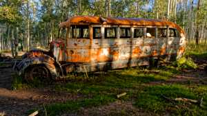
Waypoint 3 (37.7153, -112.8695) |
 |
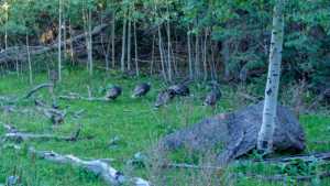
Waypoint 4 (37.7153, -112.8695) |
 |
Waypoint 5 (37.7382, -112.8622) |
 |
Waypoint 6 (37.7556, -112.8435) |
 |
Waypoint 7 (37.7556, -112.8435) |
 |
Waypoint 8 (37.7556, -112.8435) |
 |
Waypoint 9 (37.7569, -112.8455) |
 |
Waypoint 10 (37.7569, -112.8455) |
 |
Waypoint 11 (37.7569, -112.8455) |