Heber Mountain Spur 1 branches off the Heber Mountain road system in the Uinta-Wasatch-Cache National Forest, dropping through timber on a narrow, one-vehicle-wide track. It is a short run, but the trail packs in tight corners, changing grades, and a steady loss of elevation as it works down through the trees. Stock high-clearance rigs handle it without much drama, though the lack of passing room means a little patience is required if you meet oncoming traffic.
Trail Summary
- Location: Uinta-Wasatch-Cache National Forest, near Heber City, Utah, off the Heber Mountain (FR 70096) road system
- Distance: 2.3 miles (one-way)
- Difficulty: Level 2 - Typically suitable for high clearance 2WD
- Minimum Elevation: 9,741 feet
- Maximum Elevation: 10,221 feet
- Elevation Gain: 93 feet
- Travel Time: 20 to 30 minutes one-way
Difficulty
Typically suitable for high clearance 2WD
Stock equipment is sufficient here, though the terrain will test tire traction and ground clearance in a few spots. Expect dirt and rocky tread with occasional obstacles under 9 inches, such as embedded rocks, dips, and ruts. Grades are moderate and traction is generally good, but the trail is only one to two vehicles wide with limited spots to pass, so slow, deliberate driving is the norm.
Elevation
The trail starts near 10,150 feet and works its way down to about 9,741 feet at its lowest point, with a brief rise to 10,221 feet early on before the descent begins in earnest. Total elevation gain along the route comes to roughly 93 feet, while total loss adds up to about 529 feet, for a net drop of around 436 feet from start to finish. The descent is steady rather than abrupt, spread across the full length of the spur.
Terrain
This is mountain shelf road and rocky two-track, threading through dense pine and aspen stands as it winds down the mountainside. The route bends through a long series of curves rather than running straight, following the contour of the slope. Surface conditions alternate between packed dirt and sections of embedded rock, with the trail narrowing enough in places that there is nowhere to pull off.
4WD Experience
A high-clearance 4WD will move through this spur with little difficulty, but the driving style should stay cautious. The trail is narrow enough that blind corners are a real concern, and the tree cover limits sightlines further. Tire placement matters more on the rockier stretches, and the steady downhill grade means keeping the vehicle in a lower gear helps control speed without riding the brakes the whole way down.
Travel Time
The recorded track covered the 2.3-mile run in well under 10 minutes, but that reflects a single continuous pass with no stops. A more realistic pace for a high-clearance 4WD, accounting for the blind corners, narrow tread, and any pauses to check for oncoming traffic or take in the views, runs 20 to 30 minutes one-way.
Highlights
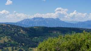
The upper section opens to views out over the Heber Valley before the trail drops back into the trees. Aspen and pine cover much of the route, with dappled light through the canopy on clear days. As a spur trail, it also serves as a quieter alternative to the main Heber Mountain road, with less traffic and a good chance of solitude.
Map
Interesting Waypoints
Waypoint 1

Waypoint 2

Waypoint 3

Waypoint 4

Waypoint 5

Waypoint 6

Waypoint 7

Waypoint 8

Waypoint 9
Waypoint 10

Waypoint 11
