High Mountain Road climbs onto a quiet corner of the Markagunt Plateau in Dixie National Forest, just a few miles from Brian Head. The route runs through mixed conifer forest, gaining a modest amount of elevation as it winds up toward a high point near 9,900 feet.
The road tops out at a flat, forested spot with room for a handful of rigs to camp, then continues down the other side back toward the trailhead. It is a straightforward backcountry drive that still delivers the views and quiet that draw people to this part of southern Utah.
Trail Summary
- Location: Brian Head, Utah
- Distance: 17.3 miles
- Difficulty: 2
- Elevation: 9,629 ft to 9,938 ft with a 308 ft change
- Travel Time: 1 hour 34 minutes
Difficulty
Typically suitable for high clearance 2WD
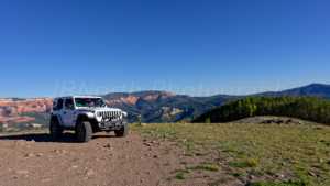
Stock equipment is enough for this drive, though the surface will test tire traction and clearance in spots. Expect dirt and rocky road with small dips and ruts under 9 inches, along with grades that can get steep but generally hold good traction. Roads stay one to two vehicles wide for most of the route, and the wide, flat area at the top has held three to four rigs for those looking to camp up high.
Terrain
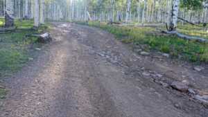
The road surface is a mix of packed dirt and scattered rock, typical of forest roads on the Markagunt Plateau. It climbs gradually through stands of spruce, fir, and aspen, with occasional open stretches that open up views across the surrounding ridgelines. The grade is gentle for most of the drive, with a short push near the high point before the road levels out and begins its descent back toward the start.
History
The Markagunt Plateau, which this road crosses, takes its name from a Paiute word meaning "highland of trees," a fitting description of the dense conifer forest that covers most of the area. The plateau itself formed through a long history of volcanic activity, leaving behind the cinder cones, lava flows, and lava tubes found throughout this part of Dixie National Forest.
High Mountain is one of several named summits scattered across this volcanic tableland, situated within a stretch of forest that has long served as a summer range for wildlife and a network of old logging and forest access roads, many of which have since become popular backcountry driving routes.
Highlights
The high point of the drive offers a flat, shaded spot to stop and take in the view, with enough room for a small group to set up camp for the night. The surrounding forest is thick with aspen and conifer, making this a good late summer or early fall route when the aspens turn. The area sits close to Brian Head and Cedar Breaks National Monument, making it easy to pair with other stops in the region.
Map
Waypoints
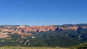 |
Waypoint 1 (37.6675, -112.9144)This is the top of High Mountain Road, where there is room to camp. A trailer that makes it up here can hold three to four rigs. |
 |
Waypoint 2 (37.6675, -112.9144) |
 |
Waypoint 3 (37.6675, -112.9144) |
 |
Waypoint 4 (37.6675, -112.9144) |
 |
Waypoint 5 (37.6751, -112.9073) |
 |
Waypoint 6 (37.6751, -112.9073) |