Horse Connect 70652 sits on the Strawberry Ridge side of the Uinta-Wasatch-Cache National Forest, southwest of Strawberry Reservoir along the Wasatch and Utah County line. The route climbs out of an open flat near the trailhead, tops a low ridge, then settles into a long, steady drop through forest and drainage country. Camping spots line the road at both ends, with more shade available the farther in you go. It is a short run at just under four miles, but the rutted middle section and the steady elevation change make it a solid test for a stock high clearance 4x4.
Trail Summary
- Location: Strawberry Ridge area, Uinta-Wasatch-Cache National Forest, southwest of Strawberry Reservoir (Wasatch/Utah County line). Closest city: Heber City, UT, reached via US-40. Closest major road intersection: US-40 near the Strawberry Ridge access road turnoff.
- Distance: 3.9 miles
- Difficulty: Level 3, best suited for a high clearance 4x4
- Minimum Elevation: 7,601 ft
- Maximum Elevation: 8,308 ft
- Elevation Gain: 287 ft
- Travel Time: About 35 minutes
Difficulty
Best suited for a high clearance 4x4
Stock vehicles with high ground clearance, 4WD capability, and off-road tires handle this trail without trouble. The road surface is more rock and undulated dirt through the middle stretch, with ruts running close to nine inches deep in the toughest section. Careful tire placement helps here, especially if the ground is wet, since the ruts can pull a tire in if you are not paying attention. The road narrows to one vehicle wide with turnouts to pass in this same area, then opens back up as it drops toward the lower end of the trail.
Elevation
The trail starts at 8,166 feet near the first camping flat and climbs through a series of switchbacks to the high point of the route at 8,308 feet, about a mile and a half in. From there it turns into a long, rolling descent, losing elevation steadily through the rest of the drive. By the low end near the last camping area, the trail has dropped to 7,601 feet, for a net loss of about 565 feet over the run. Total climbing along the way adds up to roughly 287 feet, offset by around 852 feet of descent.
Terrain
Expect mountain shelf roads and rocky two-track for most of the drive. The upper section winds through open brush and aspen with a narrower shelf-style grade, while the lower half widens into a rockier, rutted two-track as it drops through the drainage. Surface conditions shift from packed dirt near the trailhead to looser, undulated rock through the rutted middle stretch.
4WD Experience
A stock high clearance 4x4 with good off-road tires is all this trail asks for. The main obstacle is the rutted section roughly a mile and a half in, where the ruts run close to nine inches deep. Staying up on the high ground between the ruts works in dry conditions, but any moisture in the soil makes it easy to slip down into them, so slow down and pick your line before committing. Outside of that stretch, the road is a manageable mix of dirt and rock with no technical obstacles.
Travel Time
The recorded track shows about 34 minutes total, with roughly 30 minutes of that spent moving. That pace reflects a driver who already knew the road. For a first run in a stock high clearance 4x4, plan on 45 minutes to an hour to allow time to read the rutted section and enjoy the camping spots along the way.
Highlights
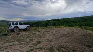
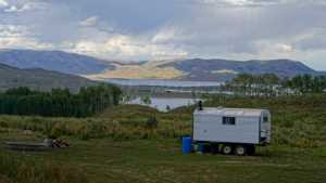
Camping is the main draw here, with open sites near the trailhead that fit multiple rigs, and shadier, more sheltered spots further along the road. The ridge climb near the start opens up views back across the basin before the trail drops into forested drainage country. The steady descent through the second half offers a good stretch of quiet two-track away from the more heavily traveled roads around the reservoir.
Map
Interesting Waypoints
Waypoint 1 (40.13771, -111.22381)
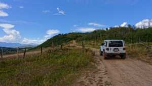
Waypoint 2 (40.13771, -111.22381)
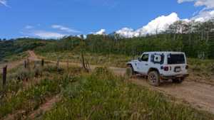
Waypoint 3 (40.13771, -111.22381)
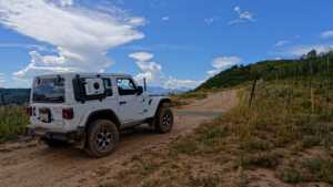
Waypoint 4 (40.14472, -111.22553)
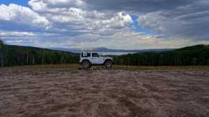
Waypoint 5 (40.14472, -111.22553)

Waypoint 6 (40.14472, -111.22553)

Waypoint 7 (40.14687, -111.22582)

Waypoint 8 (40.15192, -111.21832)

Waypoint 9 (40.15192, -111.21832)

Waypoint 10 (40.15238, -111.21226)

Waypoint 11 (40.15238, -111.21226)
Waypoint 12 (40.15525, -111.20161)
Waypoint 13 (40.16296, -111.19183)
Waypoint 14 (40.16296, -111.19183)

Waypoint 15 (40.16296, -111.19183)
