Little Pond Road is a short, easy two-track tucked into the Uinta-Wasatch-Cache National Forest northwest of Hanna, Utah. The route winds through open meadows and lodgepole pine before crossing into a stretch of standing burned timber, then returns to green forest near the far end. It's a relaxed drive suited to just about any high-clearance rig, with a couple of quiet camp spots along the way.
Trail Summary
- Location: Uinta-Wasatch-Cache National Forest, roughly 11 miles northwest of Hanna, Utah, off the West Fork Duchesne Road (FR 050) near its junction with SR-35
- Distance: 2.1 miles
- Difficulty: Level 1
- Minimum Elevation: 9,705 ft
- Maximum Elevation: 10,027 ft
- Elevation Gain: 292 ft
- Travel Time: 30 to 45 minutes
Difficulty
Suitable for high clearance 2WD
Stock equipment is sufficient here, and no special equipment is needed. The road is dirt and light gravel with only minor dips and ruts, none exceeding about 5 inches. Grades stay gentle throughout with good traction, and the road is typically wide enough for two vehicles to pass.
Elevation
The trail sits high in the Uintas, running between 9,705 and 10,027 feet. The climb is gradual and spread out over the full 2.1 miles, with a total gain of 292 feet and a loss of 151 feet, for a net gain of 142 feet from start to finish. Nothing about the grade feels steep or technical.
Terrain
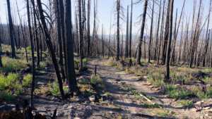
The road surface alternates between packed dirt, light sand, and scattered gravel, with one short rocky and rutted stretch partway through that's noticeably rougher than the rest. The first half mile opens through a grassy meadow before the route settles into lodgepole pine forest. Midway through, the trail climbs into a hillside burn scar, standing dead timber and blackened trunks on both sides, before dropping back into unburned forest as it continues west.
4WD Experience
This is an easy, low-stress drive. Tire placement isn't a concern outside of the one rocky, uneven section, and even that stays well within reach of a stock high-clearance 2WD. Four-wheel drive isn't necessary under dry conditions, though it adds a margin of comfort on the looser sandy stretches near the trailhead.
Travel Time
The recorded track covers the 2.1 miles in about 28 minutes of driving time. Figure on 30 to 45 minutes at a relaxed pace in a high-clearance 4WD vehicle, with extra time if you stop to walk the burn scar overlook or explore the camp spots along the way.
Highlights
The standout feature here is the burn scar roughly two-thirds of the way in, where the road climbs a hillside lined with bare, blackened trunks and offers a wide view down into the valley below. New grass and wildflowers are already filling in beneath the dead timber. There's a rocky, rutted pinch partway through the burned section that's a nice change of pace from the otherwise mellow road. On the return leg, a shaded camp spot sits back in the trees, offering a little relief from the sun but with essentially no privacy from the road.
Map
Interesting Waypoints
Waypoint 1 (40.502917°N, 110.939538°W)
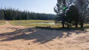
Waypoint 2 (40.502925°N, 110.939523°W)

Waypoint 3 (40.502939°N, 110.939495°W)

Waypoint 4 (40.505579°N, 110.935860°W)

Waypoint 5 (40.505638°N, 110.935723°W)

Waypoint 6 (40.505890°N, 110.926011°W)
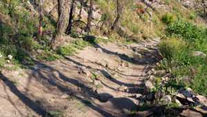
Waypoint 7 (40.504288°N, 110.924688°W)

Waypoint 8 (40.504281°N, 110.924600°W)

Waypoint 9
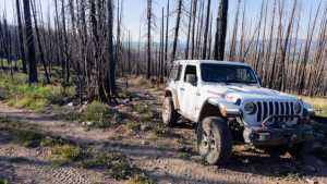
Waypoint 10
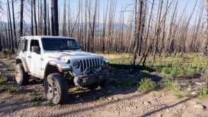
Waypoint 11

Waypoint 12
Waypoint 13

Waypoint 14

Waypoint 15

Waypoint 16

Waypoint 17 (camp spot, in the trees)

Waypoint 18 (camp spot, in the trees)

Waypoint 19 (camp spot, in the trees)
