Long Hollow is a short, unmarked spur off the Soapstone Basin trail network in the Uinta Mountains east of Kamas. It drops through a quiet stretch of lodgepole and aspen forest for under a mile before ending at an open clearing that works well as a primitive camp. Because it sees little maintenance, grass and low brush have crept in from both sides, but the tread itself stays easy to follow the whole way.
Trail Summary
- Location: Soapstone Basin, Uinta-Wasatch-Cache National Forest, near Kamas, Utah
- Distance: 0.9 miles (one way)
- Difficulty: Level 2 - Typically suitable for high clearance 2WD
- Minimum Elevation: 8,881 ft
- Maximum Elevation: 9,113 ft
- Elevation Gain: 232 ft change (trail loses elevation from start to end)
- Travel Time: 15 to 20 minutes
Difficulty
Typically suitable for high clearance 2WD
Stock equipment is sufficient, but the terrain will test tire traction and ground clearance in a few spots. Expect a dirt and rocky road with occasional ruts and low brush under nine inches that can brush the undercarriage. The grade stays moderate throughout, and traction is generally good outside of wet conditions. The road runs one to two vehicles wide for most of its length.
Elevation
The trail starts near 9,113 feet and works its way down through the trees to about 8,881 feet by the end, a loss of roughly 232 feet over less than a mile. There are no sustained climbs or steep pitches, just a steady, gentle downhill grade with a few short level stretches.
Terrain
The route follows a narrow two-track through dense lodgepole pine and aspen stands. Grass and undergrowth have reclaimed parts of the trail surface, a clear sign it doesn't get regular traffic or grading. The base is mostly packed dirt with scattered rock, and a few short washouts appear along the lower half where runoff has cut into the tread.
4WD Experience
This is a mellow, low commitment drive best suited to scouting or accessing the camp clearing at the far end. A stock high clearance vehicle will have no trouble with the surface, though the encroaching brush means a vehicle with some paint tolerance is preferable to a fresh trail rig. There's nowhere on this spur that calls for low range, but the narrow width limits any real ability to turn around until you reach the clearing.
Travel Time
At this short distance, most of the drive time goes to picking a line through the brushy sections rather than covering ground. Figure 15 to 20 minutes one way for a high clearance 4WD moving at a relaxed pace, longer if you stop to clear deadfall or explore the camp area.
Highlights
The trail's main draw is the open clearing at its upper end, a flat, sunny spot that makes an easy, low key campsite tucked back from the main Soapstone Basin routes. The forest along the way is thick and quiet, with good afternoon light filtering through the aspens on the lower stretch.
Map
Interesting Waypoints
Waypoint 1 (40.562892, -111.070052)

Waypoint 2 (40.562893, -111.070054)
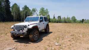
Waypoint 3 (40.562894, -111.070056)
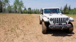
Waypoint 4 (40.561058, -111.070731)
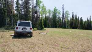
Waypoint 5 (40.561063, -111.070736)
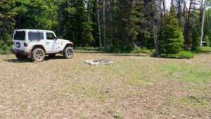
Waypoint 6 (40.555832, -111.071077)

Waypoint 7 (40.555827, -111.071054)
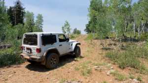
Waypoint 8 (40.554071, -111.066316)

Waypoint 9 (40.554070, -111.066316)
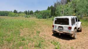
Waypoint 10 (40.554065, -111.066306)

Waypoint 11 (40.554065, -111.066306)
