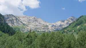
Milk Maid Road climbs out of American Fork Canyon above Silver Lake Flat Reservoir, gaining nearly 800 feet in a mile and a half through pine forest, open meadow, and a rocky shelf road cut into the canyon wall. It shares the drainage with the tougher Major Evans route on the opposite slope, but Milk Maid stands on its own with a string of hidden camping spots, a couple of stream crossings, and a climb across an old avalanche chute before the road runs out near the ridge.
Trail Summary
- Location: Uinta-Wasatch-Cache National Forest, above Silver Lake Flat Reservoir in American Fork Canyon. Closest city: Alpine, UT. Closest major road intersection: UT-92 and UT-144 (North Fork junction), American Fork Canyon.
- Distance: 1.5 miles one-way
- Difficulty: Level 3, with an optional harder line up to Level 4
- Minimum Elevation: 7,742 ft
- Maximum Elevation: 8,569 ft
- Elevation Gain: 783 ft
- Travel Time: Approximately 45 to 60 minutes one-way
Difficulty
Best suited for a high clearance 4x4
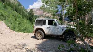
Stock vehicles with good ground clearance, 4WD, and off-road tires handle Milk Maid without much trouble. The road surface is rocky and uneven through most of the climb, with obstacles under a foot tall including ledges, short drops, and a couple of water crossings less than a foot deep. Careful tire placement helps in a few spots, and the road stays one vehicle wide with occasional places to pass.
One climb partway up the trail pushes into Level 4 territory. It is steeper, looser, and slightly off camber, with rock stacked closer to 18 inches, and low range gearing is a good idea there. Drivers who would rather skip it can take it slow and spot through, since the rest of the trail stays within Level 3 limits.
Elevation
The trail starts at 7,742 feet at the gate off the Silver Lake Flat road and climbs steadily to 8,569 feet near its end below the ridgeline. Elevation gain runs about 783 feet over the 1.5 miles, with only around 48 feet of loss along the way, so the drive is a near constant, gradual climb with a handful of short steep pitches mixed in.
Terrain
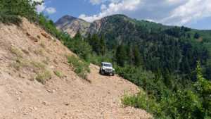
Milk Maid runs through mountain shelf roads and rocky two-track. The lower half winds through lodgepole and fir forest past several camping pull-offs, then opens into a meadow with views of the surrounding peaks before narrowing into a shelf cut along the canyon wall. The upper section crosses an old avalanche chute and finishes on a tight, exposed shelf road above the reservoir.
4WD Experience
The first half mile is mellow, a dirt two-track through the trees with a few rock-lined pull-offs for camping. Past the cluster of campsites around the half-mile mark, the trail hits its first real climb, a rocky pitch steep enough that four-wheel drive is required to clear it cleanly. A second hard section follows shortly after, still within Level 3 but noticeably tougher, and a third spot beyond that tests traction again before the grade eases off.
Once the trail opens into the meadow, the driving gets easier for a stretch before it narrows onto the shelf road. The avalanche chute crossing is loose underfoot and exposed along the outside edge of the valley, so smooth throttle control matters more than speed. A shallow water crossing follows, along with a couple of spots where rock slides have come down across the road. Both were open and passable at the time of this scout, but conditions in that chute and the slide areas can change after storms or heavy snowmelt.
The trail ends abruptly below the ridge. There is a short stretch beyond the last turnaround, maybe thirty feet, but no room to turn a vehicle around up there without tight maneuvering. The practical end of the line and the best place to turn back is about two hundred feet before that point.
Travel Time
Milk Maid is short, but the rocky climbs and the shelf road sections slow the pace. Plan on 45 to 60 minutes one-way for a high clearance 4WD, more if the group stops to look at the camping spots or the views along the shelf road. Add return time for the drive back down, since there is no loop and no room to turn around past the marked turnaround point.
Highlights
Camping is the standout feature of the lower trail. There is a spot right at the gate for two or three rigs, and a shaded pocket about a half mile in with at least six separate sites, all with trees, privacy, and a stream close by. Farther up, past the water crossing, a small hideaway campsite tucked in the trees has a stone fire ring and benches, big enough for one rig or a tent.
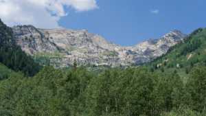
The views open up in the meadow below the shelf road, looking out at the surrounding peaks, and again near the top of the trail where Silver Lake Flat Reservoir comes into view down in the canyon. The avalanche chute crossing and the narrow shelf sections above it are the visual highlight of the upper trail, with exposure out over the valley on one side and bare granite peaks rising on the other.
Map
Interesting Waypoints
Waypoint 1 (40.514374, -111.655039)
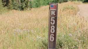
Waypoint 2 (40.514385, -111.655049)

Waypoint 3 (40.514393, -111.655056)

Waypoint 4 (40.514410, -111.655071)

Waypoint 5 (40.516004, -111.656377)
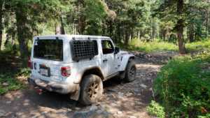
Waypoint 6 (40.516061, -111.656395)

Waypoint 7 (40.516064, -111.656393)

Waypoint 8 (40.519682, -111.656440)
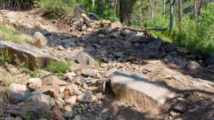
Waypoint 9 (40.521329, -111.657135)

Waypoint 10 (40.524433, -111.658802)

Waypoint 11 (40.524433, -111.658867)

Waypoint 12 (40.523725, -111.661839)

Waypoint 13 (40.523721, -111.661837)

Waypoint 14 (40.521020, -111.660424)
Waypoint 15 (40.521022, -111.660426)

Waypoint 16 (40.521024, -111.660430)

Waypoint 17 (40.521027, -111.660435)

Waypoint 18 (40.521028, -111.660436)

Waypoint 19 (40.519991, -111.660365)

Waypoint 20 (40.519989, -111.660366)

Waypoint 21 (40.519989, -111.660367)

Waypoint 22 (40.519988, -111.660367)
Waypoint 23 (40.519977, -111.660374)

Waypoint 24
Waypoint 25