Monroe Canyon Road climbs out of the high desert near the Sevier Valley, follows a creek up through Monroe Canyon, and works its way over the shoulder of Monroe Mountain in the Fishlake National Forest before dropping into the canyon bottom at the Monrovian Trailhead just outside Monroe. Along the way the road passes streamside camp spots tucked in gambel oak and aspen, crosses a short stretch of private land, and threads several narrow shelf sections cut into the canyon walls.
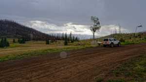
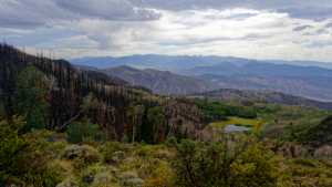
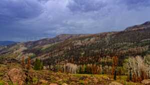
A good portion of the upper route runs through the burn scar left by the 2025 Monroe Canyon Fire, and evidence of subsequent flash flooding and debris flow is visible in the lower canyon. Along the way there are wide views of the Sevier Valley, a small trailside memorial, and several named landmarks including Solomon Hill Flat, Tom's Pitch, Devil's Dutch Oven, and Quaking Aspen Pitch.
Trail Summary
- Location: Monroe, Utah
- Distance: 17.4 miles
- Difficulty: Level 2
- Elevation: From 6,307 feet to 10,336 feet with a 4,029 foot change
- Travel Time: 1 hour 19 minutes
Difficulty
Typically suitable for high clearance 2WD
Stock equipment is enough for this route, though the road will test tire traction and ground clearance in a few spots. Most of the drive is a dirt and gravel forest road with gentle to moderate grades, but several shelf sections narrow down to about one to one and a quarter vehicles wide, so watch for oncoming traffic, especially around blind bends. One creek crossing partway through is called out as the hardest spot on the route, a washed out low crossing worth taking slow, particularly if it has been raining.
Terrain
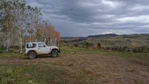
The road starts as a dirt and gravel two-track through gambel oak and scattered pine, following a creek past a string of dispersed camp spots. Higher up it climbs into aspen groves as it works around Monroe Mountain, with several stretches cut into the hillside as narrow shelf road. A long section in the middle of the drive passes through the open, blackened landscape left by the 2025 Monroe Canyon Fire, where the lower canyon also shows clear signs of flash flooding and debris flow in the years since. The road ends by dropping back into the canyon bottom near the Monrovian Trailhead outside Monroe.
Highlights
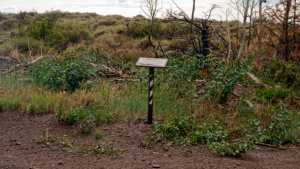
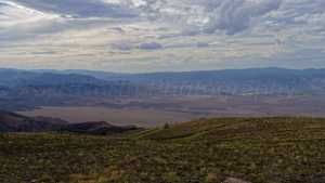
Several dispersed camp spots line the creek in the first few miles, ranging from open sunny pullouts to shaded, semi-private sites tucked in the trees. A small memorial to Norman Robinson sits along the road partway up the canyon, and informational signs mark Solomon Hill Flat and Tom's Pitch. Devil's Dutch Oven and Quaking Aspen Pitch offer good spots to stop and take in the view, with wide sweeping looks west across the Sevier Valley toward Monroe and Richfield. Pit toilets are available at the trailhead at the end of the road.
Map
Waypoints
 |
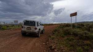
Waypoint 1 (38.4926, -111.9984)This is Monroe Canyon Road number 40078. |
 |
Waypoint 2 (38.4926, -111.9984) |
 |
Waypoint 3 (38.4926, -111.9984) |
 |
Waypoint 4 (38.4926, -111.9984) |
 |
Waypoint 5 (38.4948, -112.0033) |
 |
Waypoint 6 (38.4980, -112.0137)Camp spot with some trees and a bit of shade, no privacy, but a nice view. |
 |
Waypoint 7 (38.4980, -112.0137) |
 |
Waypoint 8 (38.4980, -112.0137) |
 |
Waypoint 9 (38.5337, -112.0522) |
 |
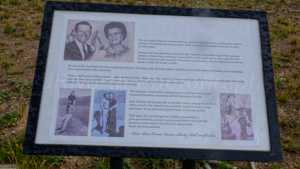
Waypoint 10 (38.5336, -112.0569)There is a memorial here for Norman Robinson, 1908 to 1965. |
 |
Waypoint 11 (38.5273, -112.0640)There is an informational sign here for Solomon Hill Flat. |
 |
Waypoint 12 (38.5273, -112.0640) |
 |
Waypoint 13 (38.5273, -112.0640) |
 |
Waypoint 14 (38.5273, -112.0640) |
 |
Waypoint 15 (38.5273, -112.0640) |
 |
Waypoint 16 (38.5273, -112.0640) |
 |
Waypoint 17 (38.5273, -112.0640) |
 |
Waypoint 18 (38.5287, -112.0684) |
 |
Waypoint 19 (38.5317, -112.0823)There is a display sign here for Tom's Pitch. |
 |
Waypoint 20 (38.5317, -112.0823) |
 |
Waypoint 21 (38.5469, -112.0825) |
 |
Waypoint 22 (38.5469, -112.0825) |
 |
Waypoint 23 (38.5472, -112.0827) |
 |
Waypoint 24 (38.5482, -112.0838)A great spot to take pictures of the valley. This is also Quaking Aspen Pitch. |
 |
Waypoint 25 (38.5542, -112.0877) |
 |
Waypoint 26 (38.5542, -112.0877) |
 |
Waypoint 27 (38.5542, -112.0877) |
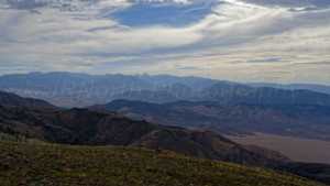 |
Waypoint 28 (38.5581, -112.0947)A great view of the valley to the west, the Sevier Valley, home to Monroe and Richfield. |
 |
Waypoint 29 (38.5581, -112.0947) |
 |
Waypoint 30 (38.5581, -112.0947) |
 |
Waypoint 31 (38.5581, -112.0947) |
 |
Waypoint 32 (38.5778, -112.0837)This is a level two hard spot, a small creek crossing that has washed out from flooding before. Use caution if it is raining. |
 |
Waypoint 33 (38.5778, -112.0837) |
 |
Waypoint 34 (38.5933, -112.0777) |
 |
Waypoint 35 (38.5933, -112.0777) |