Navajo Ridge Road climbs through the high forest just outside Brian Head, Utah, following the shoulder of Navajo Peak before crossing onto Brian Head Ski Resort land near the top. The route is short, easy to navigate, and lined with dispersed campsites for most of its length, making it a good option for a relaxed evening drive or a base camp scouting trip.
The road tops out near 10,200 feet, giving open views across the Markagunt Plateau before dropping back down toward the ridge on the far end. Cedar Breaks National Monument sits just a few minutes away by highway, and Brian Head town is within easy reach for supplies or fuel.
Trail Summary
- Location: Brian Head, Utah
- Distance: 2.4 miles
- Difficulty: Level 1
- Elevation: From 9,618 feet to 10,248 feet with a 630 foot change
- Travel Time: 15 minutes
Difficulty
Suitable for high clearance 2WD
Stock equipment is enough for this route, and no special gear is needed. The surface is dirt and light rock with gentle grades and good traction throughout, and the road stays wide enough for two vehicles to pass for most of its length. There is one short stretch near the upper end, close to where the road tops the ridge, that has been noted as a slower, more attentive spot, though it still falls within Level 1 limits.
Terrain
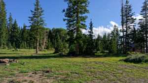
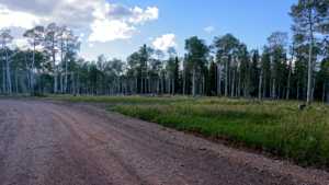
The lower half of the road winds through open and shaded forest packed with dispersed campsites, more than a dozen in total, ranging from tight single-rig spots tucked under trees to larger group sites out in the open. Pit toilets serve one of the larger camping areas near the start. Farther along, the road crosses onto private land belonging to the ski resort, where the route stays clearly defined even though the surrounding terrain looks open enough to wander off of. The road continues to climb gradually toward the ridge before easing back down on the north end near Navajo Peak.
History
Navajo Ridge takes its name from Navajo Peak, the beginner and intermediate side of Brian Head Ski Resort, home to lifts like the Navajo Express quad and runs including Navajo, Navajo Loop, and Navajo Point. The resort's Navajo Peak side has long been the gentler counterpart to Brian Head Peak across the highway, and the dirt roads that lace through the trees below it, including this one, largely predate the resort itself, having served as forest access and camping routes on the Markagunt Plateau.
The plateau itself sits within Dixie National Forest, Utah's largest national forest, and the high elevation here, close to 10,000 feet for much of the drive, keeps the area cool and heavily forested even in the middle of summer.
Highlights
The sheer number of camping pull-offs along this road makes it worth a look even for those not planning to air down, with sites suited to everything from a single small rig to a full group. The upper stretch offers a good vantage point back across the forest before the road ties into the ski resort's network of access roads and lift lines. Wildflower season in the surrounding meadows runs through mid-summer, and the proximity to Cedar Breaks National Monument makes this an easy add-on to a day already spent exploring Highway 143.
Map
Waypoints
 |
Waypoint 1 (37.6827, -112.8554)This is the start of Navajo Ridge Road. |
 |
Waypoint 2 (37.6827, -112.8554) |
 |
Waypoint 3 (37.6827, -112.8554) |
 |
Waypoint 4 (37.6827, -112.8554) |
 |
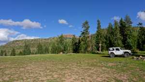
Waypoint 5 (37.6813, -112.8574)There are three campsites here, maybe more, with no shade and no privacy. Two can hold group campers, and there are pit toilets nearby. |
 |
Waypoint 6 (37.6813, -112.8574) |
 |
Waypoint 7 (37.6813, -112.8574) |
 |
Waypoint 8 (37.6813, -112.8574) |
 |
Waypoint 9 (37.6813, -112.8574) |
 |
Waypoint 10 (37.6938, -112.8757) |
 |
Waypoint 11 (37.6948, -112.8785) |
 |
Waypoint 12 (37.6948, -112.8785) |
 |
Waypoint 13 (37.6948, -112.8785) |
 |
Waypoint 14 (37.6948, -112.8785) |
 |
Waypoint 15 (37.6948, -112.8785) |
 |
Waypoint 16 (37.6948, -112.8785) |