Paiute Side Trail 44 (PST44) runs across the top of the Sevier Plateau in the Fishlake National Forest, linking the Koosharem area to the Paiute ATV Trail system on the west side of the mountain. The route covers 8.2 miles one way, climbing steadily from around 9,300 feet to just over 10,300 feet at the west end. Expect a dirt and rock forest road with a couple of private property crossings, one rutted stretch that can get sticky when wet, and several dispersed camping spots tucked into the trees along the way.
Trail Summary
- Location: Fishlake National Forest, Sevier Plateau, near Koosharem, Utah. Closest major junction is UT-24 and UT-62.
- Distance: 8.2 miles, one way
- Difficulty: Level 1, suitable for high clearance 2WD
- Minimum Elevation: 9,304 ft
- Maximum Elevation: 10,310 ft
- Elevation Gain: 996 ft
- Travel Time: about 50 minutes
Difficulty
Suitable for high clearance 2WD
Stock equipment is enough here, no special gear is needed. The surface is dirt and rock with gentle grades and good traction for most of the drive, and any rocks, dips, or ruts in the road stay under 5 inches. The road runs about two vehicles wide for most of its length, with one rutted stretch, noted below, that can slow things down when the ground is soft.
Elevation
The trail starts around 9,300 feet near the east end and climbs in a series of long, rolling grades to its high point, just over 10,300 feet, near the west end. Total climbing along the route adds up to about 1,000 feet, with only around 75 feet of descent, so the drive plays out as a steady, gradual climb from start to finish rather than an up and down ride.
Terrain
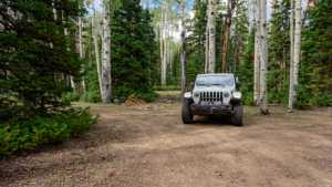
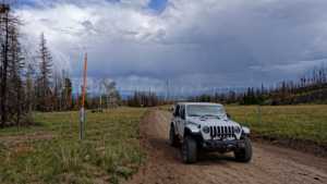
The surface is mostly hard-packed dirt with scattered rock, tracking along open meadows and stands of aspen and conifer across the top of the plateau.
4WD Experience
About two miles in, the road holds a stretch of ruts that stands out as the toughest section of the drive. It is manageable in dry conditions but would slow down and get greasy if driven after rain. Past that point the trail opens into a dispersed camping area with roughly eight spots shaded by trees, and a short spur further along leads to three tight, shaded sites, each suited to one small rig.
The trail crosses private property twice on its way west. Both crossings are controlled by cattle guards rather than gates and are marked with signs, stay on the established road through these sections.
Travel Time
The recorded drive took about 50 minutes to cover the full 8.2 miles, including stops for photos and scouting camp spots. Moving time alone was closer to 41 minutes, so a steady pace without extra stops should put most high-clearance rigs through in under an hour.
Highlights
Views open up wide across Grass Valley and the surrounding Fishlake forest the higher the trail climbs. The west end ties into the Koosharem Guard Station Road, home to the oldest Forest Service guard station still standing in Utah, built in 1911. With several camping options right off the road, this makes a solid overnight stop before continuing on to the main Paiute ATV Trail system.
Map
Interesting Waypoints
Waypoint 1 (38.55775, -111.97870)

Waypoint 2 (38.55775, -111.97870)

Waypoint 3 (38.55775, -111.97870)
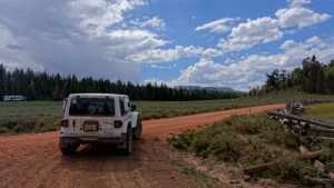
Waypoint 4 (38.55775, -111.97870)

Waypoint 5 (38.55652, -111.98987)
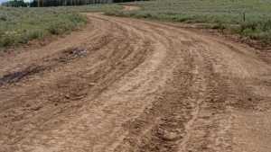
Waypoint 6 (38.55652, -111.98987)
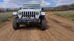
Waypoint 7 (38.55284, -111.99157)

Waypoint 8 (38.55284, -111.99157)
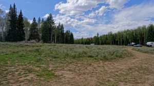
Waypoint 9 (38.55284, -111.99157)

Waypoint 10 (38.53793, -111.99884)

Waypoint 11 (38.53793, -111.99884)

Waypoint 12 (38.53793, -111.99884)

Waypoint 13 (38.53793, -111.99884)
Waypoint 14 (38.52561, -112.02477)

Waypoint 15 (38.52534, -112.04290)

Waypoint 16 (38.52534, -112.04290)
Waypoint 17 (38.52534, -112.04290)

Waypoint 18 (38.52534, -112.04290)
