South Draw Soapstone is a short connector trail dropping off the Soapstone Basin road system in the Uinta-Wasatch-Cache National Forest. It packs a rocky, technical opening into its first few hundred feet, then relaxes into an open meadow before finishing with a loose, off-camber stretch near its end.
The trail is brief, but the first section demands real attention to tire placement. Drivers looking for a quick technical detour off the main Soapstone roads will find it worth the stop.
Trail Summary
- Location: Soapstone Basin area, Uinta-Wasatch-Cache National Forest, near Woodland, Utah, off UT-35 and the Soapstone Basin road system
- Distance: 0.3 miles
- Difficulty: Level 3
- Minimum Elevation: 8,593 feet
- Maximum Elevation: 8,858 feet
- Elevation Gain: 266 feet
- Travel Time: 15 to 20 minutes
Difficulty
Best suited for a high clearance 4x4
Stock vehicles with good ground clearance, 4WD, and off-road tires handle this trail fine. The surface is rocky and uneven through the opening climb, with obstacles under a foot tall including small ledges and short, steep grades. Careful tire placement matters in the first stretch. The rest of the trail mellows out to a rutted dirt track with loose rock and the potential for soft, sandy spots.
Elevation
The trail climbs from 8,593 feet to 8,858 feet, a gain of 266 feet packed into just a third of a mile. Nearly all of that climb happens in the rocky opening section, after which the grade eases considerably through the meadow and toward the trail's end.
Terrain
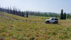
The trail starts on a tight, rocky two-track climbing away from the main Soapstone road. It opens into a broad meadow that still shows the scars of a past wildfire, offering a clear view of the burned hillside. Past the meadow, the trail narrows again and finishes on a loose, off-camber shelf before reaching its end point.
4WD Experience
Low range isn't strictly required, but it makes the opening climb easier to manage. Expect to pick a careful line over rock and through a couple of ledges right out of the gate. Once through that section, the drive settles into a relaxed cruise through the meadow. The off-camber section near the end is short but worth slowing down for, especially if the ground is wet.
Travel Time
The recorded track shows about 11 minutes of total time on the trail, with roughly 5 to 6 minutes of that spent actually moving. That pace reflects stops for photos and route-finding through the rocky opening. A realistic estimate for most high-clearance 4WD drivers, accounting for the technical start, runs 15 to 20 minutes.
Highlights
The open meadow midway through the trail is the standout feature, with wildflowers and a wide view across the wildfire burn scar on the surrounding hillside. The off-camber shelf near the trail's end adds a bit of technical interest right before the route wraps up.
Map
Interesting Waypoints
Waypoint 1 (40.54126, -111.02252)

Waypoint 2 (40.54126, -111.02252)
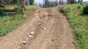
Waypoint 3 (40.54125, -111.02252)
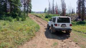
Waypoint 4 (40.54125, -111.02252)
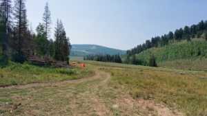
Waypoint 5 (40.54125, -111.02252)
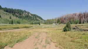
Waypoint 6 (40.53941, -111.0227)
Waypoint 7 (40.53747, -111.02196)

Waypoint 8 (40.53748, -111.02197)

Waypoint 9 (40.53748, -111.02197)
