Summit Mountain Road climbs across the shoulder of Cedar Mountain in the Dixie National Forest, linking the high country above Panguitch Lake with the Twisted Forest trailhead near Brian Head. The road threads through stands of aspen and conifer, past a handful of quiet camping pullouts, and along the edge of the Ashdown Gorge Wilderness before ending at one of southern Utah's more overlooked hikes.
The drive is a mellow, high-elevation cruise for most of its length, with a short rocky stretch and a stream crossing along the way. A brief private property section calls for staying on the road, and drivers who want a bit more challenge can add an optional harder spur near the end before parking at the trailhead.
Trail Summary
- Location: Brian Head, Utah
- Distance: 17.3 miles
- Difficulty: 2
- Elevation: From 6,017 ft to 9,453 ft with a 3,436 ft change
- Travel Time: 1 hour 34 minutes
Difficulty
Typically suitable for high clearance 2WD
Stock high-clearance vehicles handle this route without much trouble, though the terrain will test tire traction and ground clearance here and there. The road stays mostly dirt and rock with dips and ruts, plus one small stream crossing that poses no real issue in normal conditions. A short rocky pitch partway down Summit Mountain Road is the most technical spot on the main route, and it's mild enough to drive through without much thought. A steeper spur leading toward the Twisted Forest trailhead is optional and harder than the rest of the road, so drivers can take it on or stay with the easier route to reach the trailhead parking.
Terrain
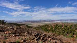
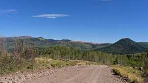
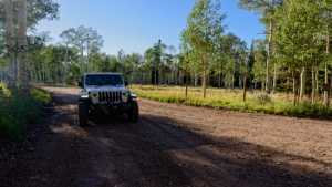
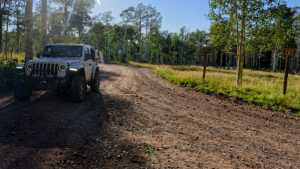
The road runs as a dirt and rock two-track across the high shoulder of Cedar Mountain, passing through aspen groves and conifer stands with several informal camping pullouts tucked among the trees. A short rocky section and a shallow stream crossing break up an otherwise steady dirt surface. Portions of the corridor burned in the 2017 Brian Head Fire and now show aspen regrowth mixed among the standing conifers. The road passes briefly through private property before entering Dixie National Forest proper, then climbs toward the Ashdown Gorge Wilderness boundary near its end, where the Twisted Forest trailhead sits at the edge of a bristlecone pine grove overlooking Cedar Breaks.
History
In June 2017, the Brian Head Fire started just a short distance from this stretch of Cedar Mountain and went on to burn more than 71,000 acres of Forest Service, state, and private land between Brian Head and Panguitch Lake. Much of Summit Mountain Road sits inside the area the Forest Service later targeted for post-fire rehabilitation, and the mix of burned snags and young aspen along the drive traces back to that summer.
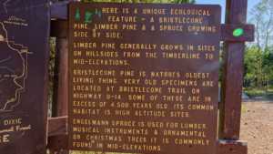
The road's southern end leads to the Twisted Forest, a grove of ancient bristlecone pines within the Ashdown Gorge Wilderness. Bristlecones are among the longest-lived organisms on earth, with some individuals in this grove estimated at well over 3,000 years old. Their gnarled, twisted shape comes from sections of each tree dying back over centuries while other parts keep growing, sculpted by wind and weather into the forms that give the grove its name.
Highlights
Several informal camping spots line the route, tucked into aspen and conifer stands with varying amounts of shade and privacy. The short rocky section and stream crossing add a little variety to what is otherwise a smooth dirt cruise. Near the southern end, the optional spur toward Twisted Forest gives drivers a taste of tougher terrain before reaching the trailhead, where a short hike leads out to a cliff overlook with sweeping views of Cedar Breaks National Monument and the Ashdown Gorge Wilderness below.
Map
Waypoints
 |
Waypoint 1 (37.797, -112.9208)There are several camping spots here among the trees, though none are private. Shorter rigs will find shade, while taller ones will be in the sun. |
 |
Waypoint 2 (37.797, -112.9208)There are several camping spots here among the trees, though none are private. Shorter rigs will find shade, while taller ones will be in the sun. |
 |
Waypoint 3 (37.797, -112.9208)There are several camping spots here among the trees, though none are private. Shorter rigs will find shade, while taller ones will be in the sun. |
 |
Waypoint 4 (37.797, -112.9208)There are several camping spots here among the trees, though none are private. Shorter rigs will find shade, while taller ones will be in the sun. |
 |
Waypoint 5 (37.797, -112.9208)There are several camping spots here among the trees, though none are private. Shorter rigs will find shade, while taller ones will be in the sun. |
 |
Waypoint 6 (37.797, -112.9208)There are several camping spots here among the trees, though none are private. Shorter rigs will find shade, while taller ones will be in the sun. |
 |
Waypoint 7 (37.7972, -112.9208)There are several camping spots here among the trees, though none are private. Shorter rigs will find shade, while taller ones will be in the sun. |
 |
Waypoint 8 (37.7972, -112.9208)There are several camping spots here among the trees, though none are private. Shorter rigs will find shade, while taller ones will be in the sun. |
 |
Waypoint 9 (37.7859, -112.9157)This campsite fits one vehicle and one tent. It isn't private, but there's a bit of afternoon shade. |
 |
Waypoint 10 (37.7768, -112.9151) |
 |
Waypoint 11 (37.7772, -112.9156)This campsite fits one rig, maybe with a trailer. It sits close to the road with no privacy, some afternoon shade, and a nice view. |
 |
Waypoint 12 (37.7734, -112.9224) |
 |
Waypoint 13 (37.7734, -112.9224) |
 |
Waypoint 14 (37.7417, -112.9367)This is a short, easy rocky stretch, rated a level one hard spot. |
 |
Waypoint 15 (37.7417, -112.9367)This is a short, easy rocky stretch, rated a level one hard spot. |
 |
Waypoint 16 (37.7417, -112.9367)This is a short, easy rocky stretch, rated a level one hard spot. |
 |
Waypoint 17 (37.7109, -112.9307) |
 |
Waypoint 18 (37.7109, -112.9307) |
 |
Waypoint 19 (37.7109, -112.9307) |
 |
Waypoint 20 (37.7109, -112.9307) |
 |
Waypoint 21 (37.6946, -112.9288)A stream crossing here, rated level one. |
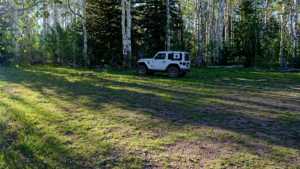 |
Waypoint 22 (37.6805, -112.9005)A couple of camping spots here sit slightly off the road for some privacy, shaded by trees. Each can hold two to three rigs. |
 |
Waypoint 23 (37.6805, -112.9005)A couple of camping spots here sit slightly off the road for some privacy, shaded by trees. Each can hold two to three rigs. |
 |
Waypoint 24 (37.6854, -112.8888) |
 |
Waypoint 25 (37.6848, -112.8863)This is the trailhead for the Twisted Forest hike, a grove of ancient bristlecone pines ending at a cliff overlook above Cedar Breaks. |
 |
Waypoint 26 (37.6848, -112.8863)This is the trailhead for the Twisted Forest hike, a grove of ancient bristlecone pines ending at a cliff overlook above Cedar Breaks. |
 |
Waypoint 27 (37.6848, -112.8863)This is the trailhead for the Twisted Forest hike, a grove of ancient bristlecone pines ending at a cliff overlook above Cedar Breaks. |
 |
Waypoint 28 (37.6848, -112.8863)This is the trailhead for the Twisted Forest hike, a grove of ancient bristlecone pines ending at a cliff overlook above Cedar Breaks. |
 |
Waypoint 29 (37.6949, -112.8786) |
 |
Waypoint 30 (37.6949, -112.8786) |