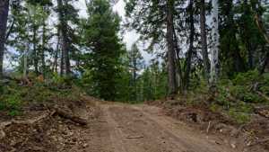
This spur drops off Vein Drill Road, Forest Road 701, in the White River drainage south of Soldier Summit. It is a narrow shelf road for most of its length, with rolling climbs and drops as it works through the timber above the river. The going stays technical enough to keep a driver's attention without turning into a true crawl.
Trail Summary
- Location: Off White River Road (Forest Road 701, Vein Drill Road), south of Soldier Summit, Wasatch County, Utah, in the Uinta-Wasatch-Cache National Forest
- Distance: 14.2 miles round trip
- Difficulty: Level 3, best suited for a high clearance 4x4
- Minimum Elevation: 8,298 ft
- Maximum Elevation: 8,937 ft
- Elevation Gain: 2,389 ft
- Travel Time: About 2 hours 15 minutes
Difficulty
Best suited for a high clearance 4x4
Stock vehicles with good ground clearance, 4WD, and off-road tires handle this spur without trouble. Expect a more rutted and undulated road surface with obstacles under 12 inches, including small ledges and a few spots where careful tire placement pays off. The road narrows to one vehicle wide through the shelf sections, with occasional loose or steep stretches and pullouts where two vehicles can pass.
Elevation
The spur climbs from 8,298 ft at its lowest point to 8,937 ft at the high point, a gain of about 610 ft net over the run. Total climbing adds up to 2,389 ft, with 1,779 ft of descent worked in along the way as the road rolls through several drainages before reaching the turnaround.
Terrain
Mountain shelf roads and rocky two-track make up the bulk of this spur. The road hugs the hillside in several places with a narrow shelf and off-camber lean, then opens back up into standard forest two-track through the timber. Surface is a mix of dirt and embedded rock, with ruts and loose sections after wet weather.
4WD Experience
Low range is not needed here, but drivers should stay alert through the shelf sections where the road narrows and cants off-camber. The toughest stretch comes partway up the spur, where the line tightens and tire placement matters more than anywhere else on the route. High clearance and 4WD keep this well within reach of a stock rig with off-road tires.
Travel Time
The recorded run took about 2 hours 15 minutes including stops, with roughly 2 hours 8 minutes of that in motion. Plan closer to 2.5 to 3 hours round trip if stopping for photos or scouting the narrower sections.
Highlights
The upper end of the spur climbs into thicker timber with good views back down the White River drainage. The narrow shelf sections offer some of the best scenery on the route, with the forest opening up along the hillside. Wildlife and quiet camping spots are common through this stretch of forest south of Soldier Summit.
Map
Interesting Waypoints
Waypoint 1 (40.0195, -111.059895)

Waypoint 2 (40.0195, -111.059895)

Waypoint 3 (40.014805, -111.052147)
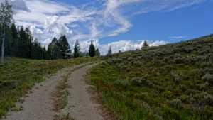
Waypoint 4 (40.014805, -111.052147)

Waypoint 5 (40.014805, -111.052147)

Waypoint 6 (40.014805, -111.052147)

Waypoint 7 (40.016393, -111.05475)
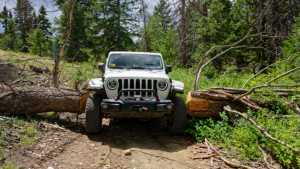
Waypoint 8 (40.016393, -111.05475)

Waypoint 9 (40.019563, -111.059885)

Waypoint 10 (40.022625, -111.058287)

Waypoint 11 (40.022625, -111.058287)
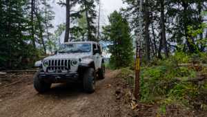
Waypoint 12 (40.022625, -111.058287)

Waypoint 13 (40.0226283333, -111.058288333)