West Side Strawberry runs the length of the ridges and drainages on the west side of Strawberry Reservoir, dropping south for over 22 miles before ending near private property in the Indianola area. The route starts with wide open camping and reservoir views, works past the old Willow Creek Guard Station, rides a stretch of shelf road along the ridge, and finishes with a long, winding descent through sagebrush and timber. It is a good introduction to backcountry travel in this part of the Wasatch Range, with just enough washboard and ruts to keep things interesting.
Trail Summary
- Location: West side of Strawberry Reservoir, Uinta-Wasatch-Cache National Forest, Wasatch County, Utah
- Distance: 22.3 miles
- Difficulty: Level 2
- Minimum Elevation: 7,363 ft
- Maximum Elevation: 8,975 ft
- Elevation Gain: 1,991 ft
- Travel Time: About 1 hour 48 minutes recorded on the trail
Difficulty
Typically suitable for high clearance 2WD
Stock equipment is sufficient, but the terrain will likely test tire traction and ground clearance. Expect dirt and rocky road with potential challenges or obstacles less than 9 inches, such as rocks, dips, or ruts. Sections can be steep but with generally good traction. The road is typically unmaintained after rain or snow, and you may run into shallow water crossings and obstacles under 12 inches, including small ledges. Roads are usually one to two vehicles wide.
Elevation
The route climbs and drops through a series of ridgelines and drainages, ranging from 7,363 feet at the low point near the south end to 8,975 feet at the high point above the reservoir. Total climbing comes to about 1,991 feet, with roughly 2,202 feet of descent, for a net loss of around 210 feet from start to finish. The elevation change comes in rolling waves rather than one long grade, so the trail never feels like a single sustained climb or descent.
Terrain
Expect mountain shelf roads and rocky two-track for most of the route. The surface alternates between smooth dirt, washboard, and stretches of loose rock and ruts, with one notable rough section near the guard station where the road gets uncomfortable with washboard and scattered rock. A shelf road section further south narrows the road but still leaves room to pass, running along a ridge with open views across the surrounding mountains and down into the valleys. The far south end tightens up again and runs close to private property, so staying on the road matters here.
4WD Experience
A stock high clearance vehicle handles this trail without issue. The roughest stretch comes early, near the Willow Creek Guard Station, where washboard, ruts, and loose rock slow the pace and make for an uncomfortable but manageable few miles. The shelf road section further south is wide enough for one and a half vehicles with turnouts to pass, so it does not require the tight tire placement of a narrower trail. The final push toward the south end is a bit harder again, still within Level 2 limits but worth a slower pace given the private property boundary nearby.
Travel Time
The recorded track shows about 1 hour 48 minutes total, with roughly 1 hour 29 minutes of that spent actually moving. For a high clearance 4WD vehicle running the trail at a deliberate pace, plan on 2 to 2.5 hours to cover the full 22 miles, more if you stop to check out camping spots, the guard station, or the ridge views along the way.
Highlights
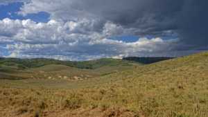
The trail opens with sweeping views of Strawberry Reservoir from a string of open camping spots right at the start, none of them shaded but all with easy access. Willow Creek Guard Station, reached via Spur 70453, is a worn but maintained pair of buildings with a usable outhouse. Further south, the road climbs onto a ridge with long views across the surrounding mountains and down into the valleys below, and a shelf road section adds a bit of exposure without narrowing things down too much. More dispersed camping spots appear throughout, some with a bit more shade and privacy than the reservoir-side sites at the start.
Map
Interesting Waypoints
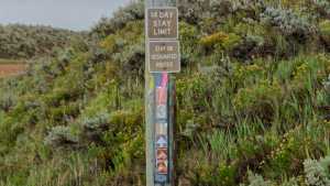
Waypoint 1 (40.121447, -111.155098)
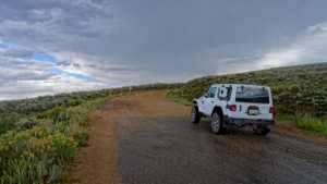
Waypoint 2 (40.121447, -111.155098)
Waypoint 3 (40.120053, -111.151898)

Waypoint 4 (40.120053, -111.151898)
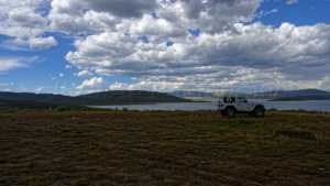
Waypoint 5 (40.120053, -111.151898)
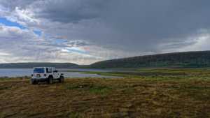
Waypoint 6 (40.030278, -111.151470)

Waypoint 7 (40.030278, -111.151470)

Waypoint 8 (40.030278, -111.151470)
Waypoint 9 (40.029793, -111.151030)
Waypoint 10 (40.029793, -111.151030)

Waypoint 11 (40.025052, -111.145997)

Waypoint 12 (40.012848, -111.167555)

Waypoint 13 (39.996587, -111.170485)

Waypoint 14 (39.996587, -111.170485)

Waypoint 15 (39.996587, -111.170485)

Waypoint 16 (39.996587, -111.170485)

Waypoint 17 (39.961082, -111.101498)

Waypoint 18 (39.925327, -111.069965)

Waypoint 19 (39.925327, -111.069965)

Waypoint 20 (39.925327, -111.069965)

Waypoint 21 (39.925327, -111.069965)
